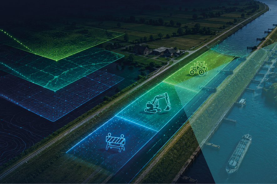
Waterway & flood-defense clearance | Dikes, canals & banks

Recognize this?
A farmer, a contractor and a municipality all need access to the same stretch of embankment this season.
Each request arrives as a description. Your inspectors lose hours cross-referencing paper maps and separate GIS databases just to work out whether the three of them collide.
Precision guardrails for linear domains
Eaglebe Spatial Orchestration brings precision and control to linear domains: applicants draw the exact footprint, it’s automatically checked against your ArcGIS guardrails, and routed to the right regional inspector—fast, consistent, and defensible.


Applicants draw the exact shape of their intended works on the corridor.
Eaglebe SOP cross-references each shape against your structural buffer zones and soil-sensitivity lines in ArcGIS.

Valid requests are filtered and distributed to the regional teams automatically.

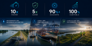
More clearances. Less workload.
Across Eaglebe deployments, a transparent, map-driven portal typically doubles submitted applications while cutting the handling effort dramatically — because rules are enforced upfront, footprints are auditable, and high‑risk work gets filtered out before it reaches your team.

For who and some figures…
Book a Demo! And guard your physical domain — on one map
See how Eaglebe Spatial Orchestration turns your existing GIS into an active clearance engine, so you can coordinate works, manage risk, and prevent conflicts before anyone breaks ground.
Book your demo!